
%20(2).png)
If you scan the headlines coming out of European defense ministries, aerospace forums, and homeland security agencies, a profound paradigm shift is underway. For years, the global conversation surrounding Unmanned Aerial Systems (UAS) focused predominantly on offensive capability, how fast fleets could be scaled, how payloads could be optimized, and how low-cost technology could disrupt traditional military paradigms.
Today, the conversation has completely flipped. The urgent question facing national security teams, critical infrastructure operators, and border agencies alike is no longer how to deploy drones, but how to detect and track them before they reach sensitive perimeters.
From the Baltic coastline to Western Europe, traditional airspace defense models are proving fundamentally inadequate against a new breed of low-altitude, small-scale threats. Traditional, multi-million-dollar air defense radars are finely tuned for high-altitude, fast-moving, metallic targets like fighter jets or ballistic missiles. Consequently, they are effectively blind to small, low-flying Class 1 and Class 2 commercial and tactical drones.
At SkyMapper, we have been tracking these developments closely. The structural vulnerabilities being exposed on the global stage are the exact reasons we engineered our newest innovation. The SkySphere, our rugged, all-sky imaging and edge-processing hub, is designed to close the low-altitude visibility gap. By combining 360° horizon-to-horizon images, localized Edge AI, and tamper-proof blockchain ledger verification, SkySphere provides commercial, scientific, and security operators with a defense-grade solution for total sky awareness.
The Strategic Shift to Continuous Airspace Monitoring
The limitations of legacy security grids have forced a massive overhaul in how European nations conceptualize airspace sovereignty. A prime example is the multi-billion-euro "Drone Wall" initiative, which aims to secure a 4,000-kilometer border stretching from Finland to Romania. As highlighted in a comprehensive D-Fend Solutions Brief, guarding against asymmetric threats requires moving entirely away from legacy radars and investing heavily in distributed, RF-cyber and optical tracking networks capable of spotting drones via their unique signatures.
This continental vulnerability led to a major legislative milestone when the European Commission published its formal Action Plan on Drone and Counter-Drone Security. The European Union designated "boosting detection capacities" as a primary defense pillar, mobilizing over €400 million in dedicated security funding to eliminate systemic blind spots, as reported by Eunews.
However, building a physical and technological barrier of this scale introduces massive coordination challenges. In an analysis by GNET Research, researchers questioned the resilience of the proposed EU Drone Wall against asymmetric and non-state extremist actors, noting that true safety relies on multi-sensor, automated visibility rather than isolated checkpoints.
To overcome this, engineers are exploring radically creative solutions. A tactical breakdown detailed by MediaLaws notes that the EU is looking into leveraging existing 5G telecommunication networks for cellular sensing, allowing authorities to track unmapped, unpowered, or radio-silent low-altitude threats that deliberately evade radio frequency detection.
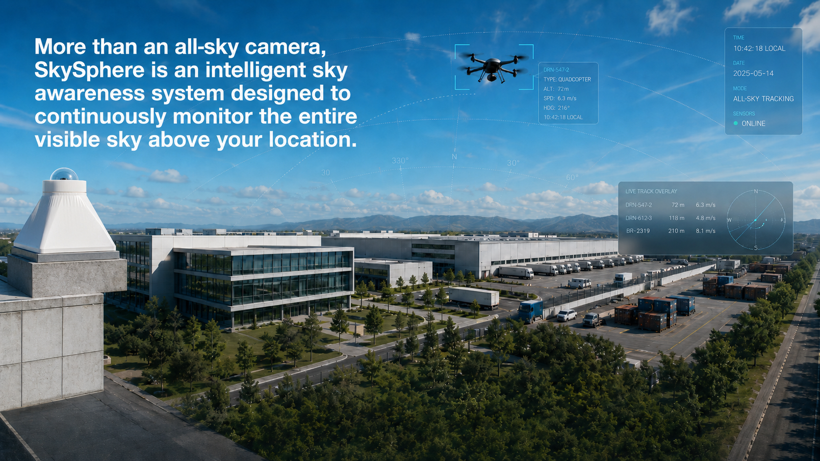
Moving From Experiments to Real Infrastructure
What was once confined to military testing ranges is now hitting civilian and commercial perimeters. As tracked by Dronelife, counter-UAS platforms are rapidly transitioning into standardized, permanent utility infrastructure across NATO's eastern flank to protect energy grids, transport hubs, and localized populations.
Forward-deployed states are leading this operational charge. In Estonia, massive defense infrastructure acceleration has led to real-world deployment of integrated targeting networks like the British Army's "ASGARD" program, profiled by Breaking Defense. These digital webs allow border troops to dynamically detect, track, and share data on incoming hostile objects across vast boundaries in real time.
Similarly, during NATO's recent Bold Machina exercises covered by Navy.mil, special operations forces successfully validated prototype passive detection systems. By fusing long-range electro-optical/infrared arrays with localized artificial intelligence, they proved that forces could successfully track hard-to-detect Class 1 enemy drones completely silently, without emitting radar signals that give away their own coordinates.
Engineering the Solution: Inside the SkySphere Architecture
The core vulnerabilities dominating international defense headlines boil down to three primary issues: narrow-angle camera traps, cloud-processing latency, and data integrity validation. The SkySphere ecosystem was built from the ground up to solve these exact problems for organizations that need to see more, verify more, and respond faster.
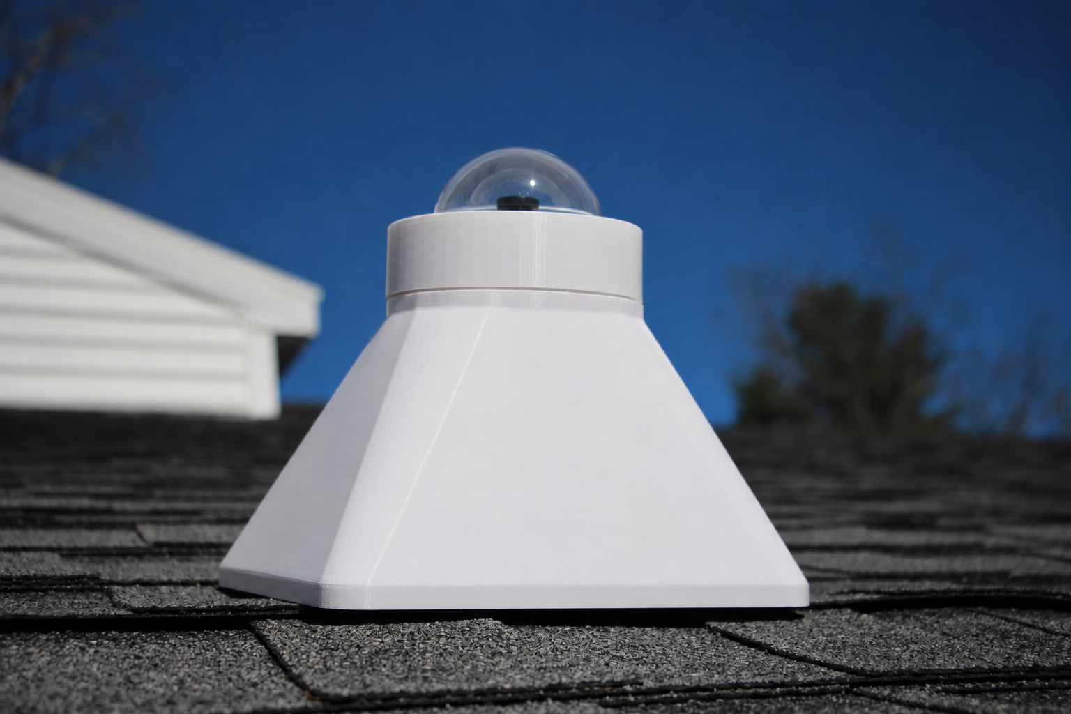
1. Defeating the "Narrow-Angle Trap" with Panoramic Imaging
Traditional surveillance infrastructure relies heavily on pan-tilt-zoom (PTZ) cameras or directional systems. If an unauthorized drone approaches from an unmonitored vector or a multi-directional swarm is deployed, mechanical cameras simply cannot keep pace.
SkySphere eliminates this vulnerability by utilizing dedicated hemispherical optics. Instead of panning back and forth, SkySphere captures continuous 360° horizon-to-horizon panoramic imagery. By monitoring the entire hemisphere simultaneously, it guarantees that fast-moving overflights or transient events are never missed due to a camera facing the wrong direction.
.png)
2. Eliminating Latency with Real-Time Edge AI
Many modern commercial security systems stream raw high-definition video back to centralized cloud servers for AI analysis. In a security breach, this introduces bandwidth strain and dangerous processing latency.
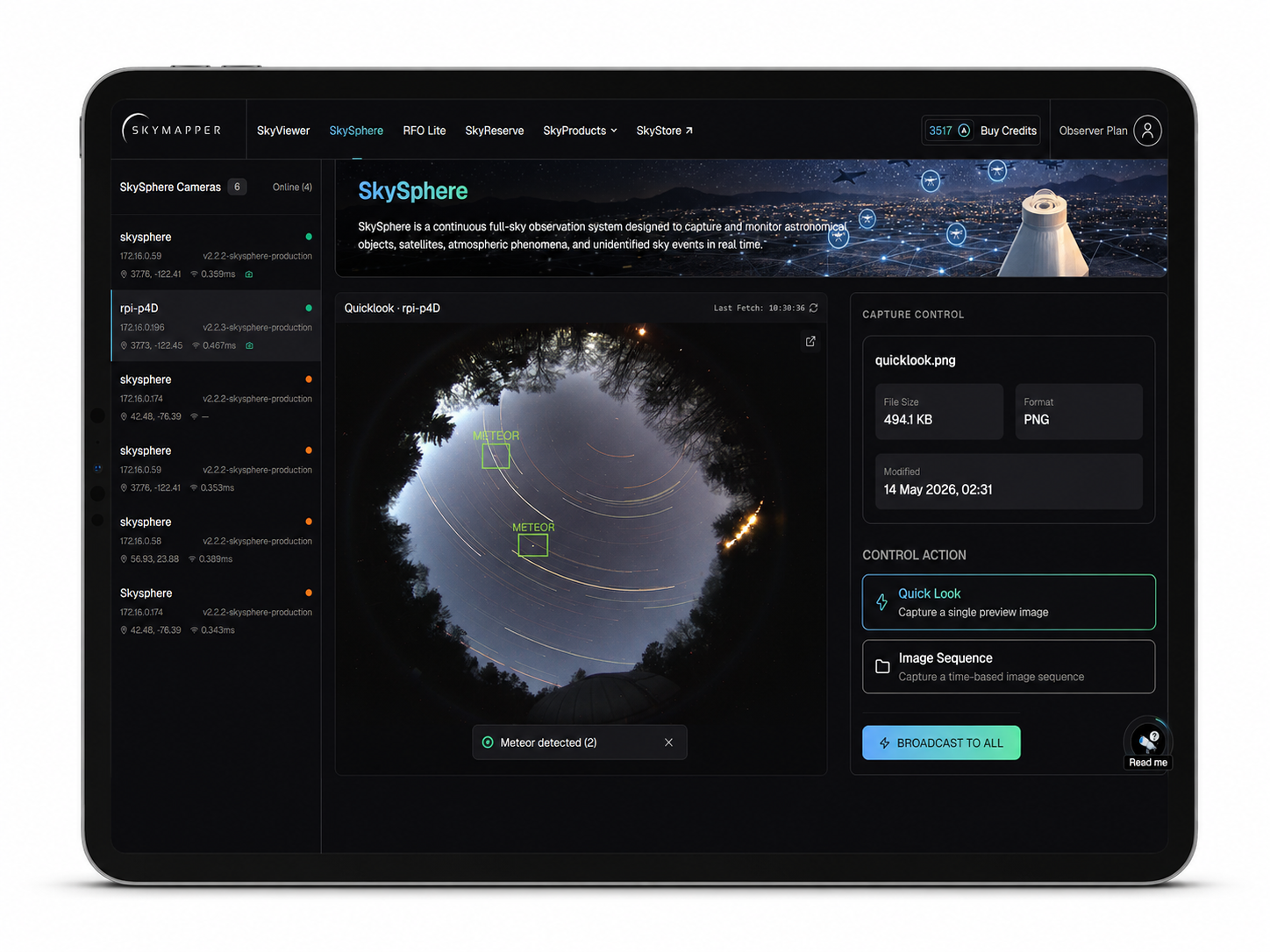
SkySphere features a built-in, trusted edge-hardware architecture powered by an advanced System-on-Chip (SoC) with a dedicated Neural Processing Unit (NPU). This allows the device to run sophisticated computer vision algorithms natively at the edge. SkySphere automatically detects, classifies, and tracks transient aerial objects right on the device, filtering out environmental noise like birds or clouds, and instantly triggers automated alerts to drastically compress the window between observation and action.
3. Guaranteeing Integrity with Cryptographic Sealing
In an era of sophisticated data spoofing and deepfakes, capturing visual evidence of an airspace violation is only half the battle. For corporate compliance, legal escalation, and insurance investigation, operators must possess unassailable proof of data integrity.
SkySphere builds an ironclad chain of custody at the exact millisecond of capture. Utilizing an integrated GNSS system, every single frame is injected with precise time and location metadata. The device's internal hardware secure element then generates an on-device cryptographic hash of the observation. This proof of provenance is periodically anchored to the immutable SkyMapper blockchain ledger via our proprietary Proof-of-Space-Origin mechanism, yielding a tamper-evident, court-admissible record of exactly what happened, when it occurred, and where it was captured.
Built for the Toughest Frontiers
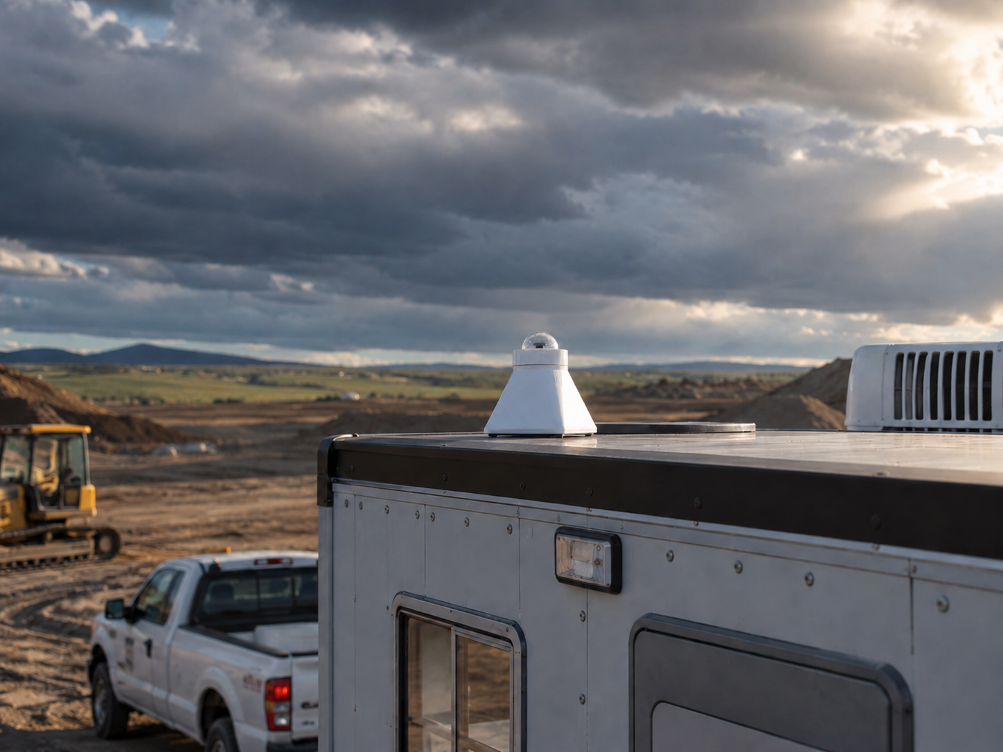
True situational awareness demands hardware that survives the elements it is deployed to watch. Reflecting the rigorous demands of border tracking and critical infrastructure environments, SkySphere is built for rugged, continuous outdoor deployment.
The protected and coated optics prevents visual artifacts while defending the lenses against solar degradation. The entire base housing features an IP65/IP66 weatherproof ingress rating, ensuring seamless, 24/7 operation through torrential downpours, blowing dust, and extreme temperatures. With out-of-the-box built-in Wi-Fi, SkySphere can be seamlessly mounted to fixed facility roofs, remote security poles, or mobile field tripods.
The Power of the Network: The SkyMapper Ecosystem
One of the most striking takeaways from international defense networks is that security is optimized through collaboration. Isolated sensor nodes create data silos; interconnected sensor grids create a matrix of resilience.
This is the driving philosophy behind SkyMapper, our cryptographically secure global network of astronomical devices. Every SkySphere deployed operates as a vital, active node within the broader SkyMapper ecosystem. Distinct devices can securely interact, expanding an operator's visibility well beyond their immediate physical horizon. For large industrial complexes, sprawling commercial logistics hubs, or collaborative research networks, this architecture allows adjacent nodes to dynamically share tracking and telemetry data, ensuring seamless, end-to-end situational awareness across distributed boundaries.
One System. Many Crucial Missions.
While the modern security landscape makes SkySphere an absolute necessity for Aerial Security and Critical Infrastructure Protection, its unique architecture makes it exceptionally versatile across multiple distinct fields:
- Remote Site & Weather Monitoring: Providing automated, real-time cloud-cover estimations, environmental monitoring, and localized site safety assessments for unmanned field infrastructure and remote utility stations.
- Scientific Research: Empowering astronomical networks and research teams with highly dependable, time-calibrated datasets for tracking meteors, bright satellite passages (including the ISS), auroras, light-pollution monitoring, and other transient atmospheric anomalies.
- Education & STEM Outreach: Streaming authentic, live-sky observation streams directly into classrooms and planetariums, replacing generic archived media with real-time, trustworthy data to inspire the next generation of scientific explorers.

Monitor Your Sky with Confidence
The skies overhead are evolving at an unprecedented pace. The lessons of the past year prove that relying on narrow views, high latency, and unverified visual records creates an unacceptable level of operational risk. Whether your goal is safeguarding a private industrial facility, managing a remote asset, or tracking rare celestial phenomena, SkySphere provides you with the trusted visibility required to monitor your horizon with absolute certainty.
Ready to bring defense-grade, continuous visibility to your airspace?
- Take a deep dive into our engineering architecture by reviewing the SkySphere Technical Specification Sheet.
- Explore real-time network tracking, cloud-cover metrics, and telemetry data directly on the SkyMapper Portal.
- Help us build a safer, more transparent, and more aware world by backing the SkySphere campaign on Kickstarter today.
SZ3 2026